The Gallery
Cartographic evidence and flag proposals from Meredith van der Kolk, Chief Cartographer.
A curated collection of integration cartography by Meredith van der Kolk, Chief Cartographer and Territorial Affairs. All maps use equal-area projections — principally Mollweide and Lambert Azimuthal Equal-Area — rather than the Mercator projection, which systematically misrepresents New Zealand's size and distance. The council's maps show the world as it is, not as the Mercator projection has trained people to see it.
"Maps are not opinions. Maps are evidence."
The Flag
The Southern Cross — rendered in five stars as a diplomatic compromise between Australia's six and New Zealand's four-plus-one — centred on a field of navy blue, with the Silver Fern (soon to be a protected regional emblem under Commonwealth statute) positioned in gold at the lower hoist.
The design communicates: continuity, unity, and the specific pride of a state that was always part of this story, even when it wasn't on the map.
"Good design takes time. Great design takes 47 drafts."
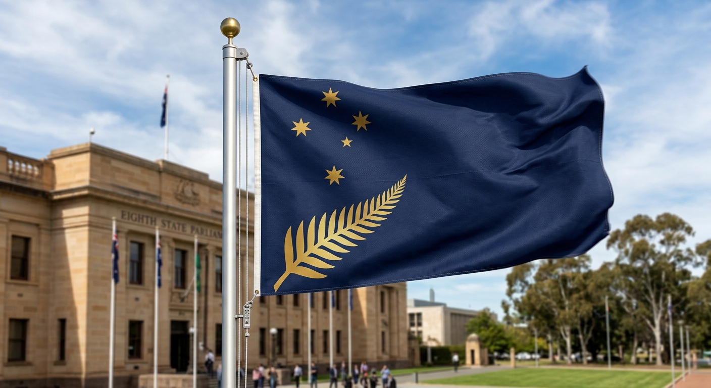
Version 47 // The Eighth State Flag // Meredith van der Kolk // 2024